How to use drone deploy – How To Use DroneDeploy unlocks the power of aerial imagery. This guide walks you through everything from setting up your account and planning flights to processing data and sharing your results. We’ll cover essential features, best practices, and troubleshooting tips to help you get the most out of this powerful platform, whether you’re a beginner or an experienced drone pilot.
We’ll explore the key aspects of DroneDeploy, from its intuitive interface and various subscription plans to advanced features like automated flight planning and data analysis. Learn how to create efficient flight plans, optimize your camera settings, and process your drone data into valuable insights, such as orthomosaics, 3D models, and elevation maps. We’ll also delve into sharing your work with collaborators and integrating DroneDeploy with other software.
DroneDeploy Account Setup and Navigation
Getting started with DroneDeploy is straightforward. This section guides you through creating your account, navigating the dashboard, and managing your flight data. We’ll also compare the different subscription plans to help you choose the best fit for your needs.
Creating a DroneDeploy Account
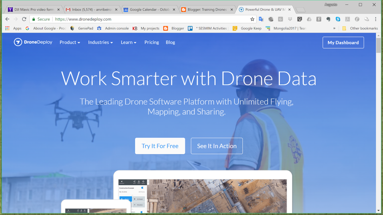
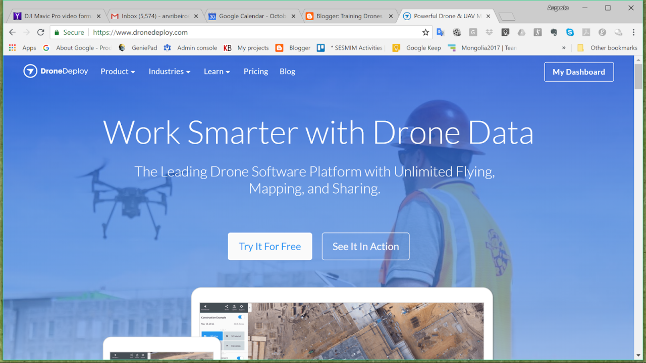
Setting up your DroneDeploy account is quick and easy. First, visit the DroneDeploy website and click the “Sign Up” button. You’ll be prompted to enter your email address, create a password, and provide some basic information about yourself and your organization. Once you’ve completed this process, you’ll receive a verification email; click the link to activate your account.
After that, you can log in and start exploring the platform.
DroneDeploy Dashboard Overview
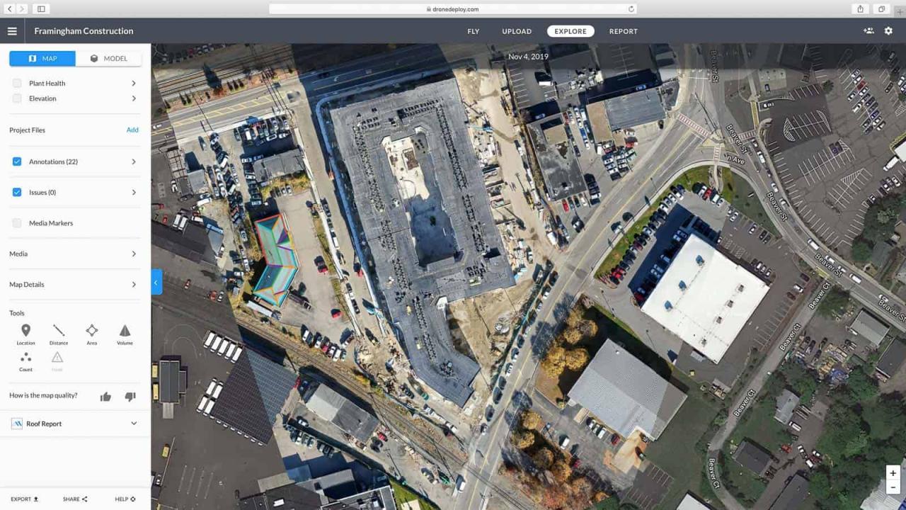
The DroneDeploy dashboard serves as your central hub for all your drone operations. Here, you’ll find options to create new projects, manage existing ones, view recent flights, access your account settings, and explore various help resources. The dashboard is intuitively designed, with clear icons and a straightforward layout, making it easy to navigate even for beginners.
Importing and Managing Flight Data
Importing flight data is a crucial step in the DroneDeploy workflow. Once you’ve completed a flight, you can import the data directly from your drone’s SD card or through cloud storage services supported by DroneDeploy. The platform allows for easy organization and management of your flight data, enabling efficient retrieval and analysis of information.
DroneDeploy Subscription Plans Comparison

DroneDeploy offers various subscription plans to cater to different user needs and budgets. Consider the following comparison table to choose the plan that best aligns with your project requirements and data storage needs.
| Plan Name | Price | Features | Data Storage Limits |
|---|---|---|---|
| Basic | $ Varies, check website | Basic processing, limited data storage, essential tools | Limited GB |
| Standard | $ Varies, check website | Enhanced processing capabilities, increased data storage, access to advanced features | Increased GB |
| Premium | $ Varies, check website | All features, highest data storage limits, priority support | High GB |
| Enterprise | Custom Pricing | Tailored solutions, dedicated support, extensive data storage and advanced features | Custom |
Planning and Preparing Flights with DroneDeploy
Before you take to the skies, careful flight planning is essential. This section covers defining flight parameters, creating flight plans, and ensuring your drone is ready for a successful mission.
Defining Flight Parameters
Within DroneDeploy, you can define crucial flight parameters like altitude, speed, and overlap. Altitude determines the height of your drone above the ground, influencing image resolution and coverage area. Speed affects the flight duration and data acquisition rate. Overlap is critical for accurate data processing and creating seamless mosaics; typically, 70-80% side and 60-70% forward overlap are recommended.
Creating and Managing Flight Plans
DroneDeploy supports various mapping techniques for flight planning, including grid and corridor mapping. Grid mapping is ideal for large, uniform areas, while corridor mapping is suitable for linear features like roads or pipelines. You can easily adjust the flight plan parameters within the platform to optimize coverage and data quality.
Getting started with drone mapping? First, you’ll want to plan your flight path carefully. Then, check out this awesome guide on how to use DroneDeploy to learn how to import your flight plan and process the resulting imagery. Finally, mastering post-processing techniques in DroneDeploy will unlock the full potential of your drone data for creating professional-quality maps and models.
Selecting Camera Settings and Image Resolution
Appropriate camera settings are crucial for achieving desired results. Higher resolution images provide greater detail but require more processing time and storage space. Consider the application; for precise measurements, higher resolutions are necessary, while lower resolutions might suffice for general inspections. Always ensure your camera settings are compatible with your drone and DroneDeploy’s processing capabilities.
Preflight Inspection Checklist
A thorough preflight inspection is critical for ensuring a safe and successful flight. Use the following checklist to verify your drone’s readiness before each mission:
- Check battery levels
- Inspect propellers for damage
- Verify GPS signal strength
- Confirm camera settings
- Review flight plan parameters
- Check weather conditions
- Ensure legal compliance
Executing and Monitoring Drone Flights
This section details the process of uploading flight plans to your drone, monitoring flights in real-time, and handling potential issues.
Uploading and Synchronizing Flight Plans
Once your flight plan is finalized in DroneDeploy, you’ll need to upload it to your compatible drone using the DroneDeploy mobile app. The synchronization process ensures that your drone receives the necessary instructions for autonomous flight. Ensure your drone is connected to your mobile device and has sufficient battery power before initiating the upload.
Monitoring Flight Progress
The DroneDeploy app allows you to monitor your flight in real-time, providing valuable insights into its progress. You can view the drone’s location, altitude, battery level, and other crucial parameters. This real-time monitoring helps in identifying and addressing potential problems during the flight.
Handling Unexpected Issues

Unexpected issues, such as low battery or GPS signal loss, can occur during flights. DroneDeploy provides mechanisms for handling these situations. If a problem arises, the app will often alert you, allowing you to take appropriate action, such as initiating an immediate return-to-home procedure.
Safe Landing and Data Retrieval
Once the flight is complete, ensure a safe landing for your drone. After landing, retrieve the flight data from your drone’s SD card or access it directly through the DroneDeploy app, depending on your chosen data storage method.
Processing and Analyzing Drone Data in DroneDeploy: How To Use Drone Deploy
DroneDeploy offers various processing options to transform your raw image data into valuable insights. This section explains the process and best practices for optimizing your data processing.
Processing Options, How to use drone deploy
DroneDeploy offers a range of processing options, including orthomosaic creation (a georeferenced mosaic of aerial images), 3D model generation, and index creation. Each option produces different deliverables, depending on your project needs. You can choose the processing options that best suit your requirements within the DroneDeploy platform.
Generating Deliverables
After processing, you can generate various deliverables, such as elevation maps, point clouds, and volume calculations. These deliverables provide valuable information for various applications, from construction site monitoring to agricultural yield estimation. The specific deliverables you generate will depend on your chosen processing options and project goals.
Optimizing Processing Settings
Optimizing processing settings is crucial for achieving high-quality results. Factors such as image resolution, overlap, and processing algorithms significantly impact the quality and accuracy of the deliverables. Experiment with different settings to find the optimal balance between processing time and data quality.
Common Processing Errors and Solutions
Various issues can arise during data processing. Understanding common errors and their solutions is vital for efficient workflow management. Here are some examples:
- Error: Insufficient overlap. Solution: Replan the flight with increased overlap.
- Error: Poor image quality. Solution: Check camera settings, lighting conditions, and ensure proper exposure.
- Error: Processing failure. Solution: Check internet connectivity, ensure sufficient storage space, and contact DroneDeploy support.
Sharing and Collaborating on DroneDeploy Projects
DroneDeploy facilitates seamless collaboration by allowing you to share data and invite collaborators to your projects. This section details the process of sharing data and managing project permissions.
Sharing Processed Data and Reports

Sharing your processed data and project reports with colleagues or clients is simple. DroneDeploy provides various options for sharing, including direct download links, cloud storage integration, and email sharing. You can also control the level of access granted to each recipient.
Exporting Data in Various Formats
DroneDeploy allows exporting data in various formats, including GeoTIFF, KML, and Shapefiles, ensuring compatibility with different software applications. The specific export options available will depend on the type of data and the chosen processing options.
Inviting Collaborators and Managing Permissions
You can easily invite collaborators to your projects and manage their permissions. You can assign different roles to collaborators, granting them varying levels of access to project data and settings. This ensures controlled access and efficient teamwork.
Creating Professional Reports
DroneDeploy’s reporting tools help create professional reports summarizing project findings. You can customize reports with various data visualizations, including maps, charts, and 3D models. These reports can be exported in various formats for easy sharing and distribution.
- Select the project you want to create a report for.
- Navigate to the “Reports” section.
- Choose the desired report template or create a custom report.
- Customize the report with relevant data and visualizations.
- Review and export the report in the desired format (PDF, etc.).
Advanced DroneDeploy Features and Integrations
DroneDeploy offers advanced features and integrations to enhance your workflow and unlock greater insights from your data. This section explores these capabilities and their applications across various industries.
Automated Flight Planning and Data Analytics
DroneDeploy’s advanced features include automated flight planning, allowing for efficient mission planning and execution. Its data analytics capabilities enable extracting valuable insights from processed data, providing a deeper understanding of your project area.
Integration Capabilities
DroneDeploy integrates with various software platforms, including GIS software, enhancing workflow efficiency and data analysis. These integrations streamline data exchange and analysis, improving overall project management.
Data Analysis Techniques
DroneDeploy supports several data analysis techniques, including measurements, volume calculations, and change detection. These techniques help extract meaningful insights from the data, providing valuable information for decision-making.
Industry Applications
DroneDeploy finds applications in various industries, including construction (site monitoring, progress tracking), agriculture (crop health assessment, yield prediction), and mining (site surveying, resource management). The platform’s versatility makes it a valuable tool across diverse sectors.
Troubleshooting Common DroneDeploy Issues
This section provides solutions to common problems encountered while using DroneDeploy, ensuring a smoother workflow.
Common Errors and Solutions
Understanding and addressing common errors is crucial for maintaining a productive workflow. Here’s a table outlining some common issues, their symptoms, causes, and solutions:
| Error Type | Symptoms | Potential Causes | Solutions |
|---|---|---|---|
| Connectivity Issues | Unable to connect to the DroneDeploy app or upload data. | Poor internet connection, server issues. | Check your internet connection, try restarting your device, contact DroneDeploy support. |
| Processing Failures | Processing jobs fail to complete or produce errors. | Insufficient processing power, data corruption, incorrect settings. | Check your processing settings, ensure sufficient storage space, contact DroneDeploy support. |
| Data Import Issues | Unable to import flight data from your drone. | SD card issues, incompatible file formats, data corruption. | Check your SD card, ensure correct file formats, try re-importing the data. |
Accessing DroneDeploy Support Resources
DroneDeploy provides comprehensive support resources, including a help center, FAQs, and contact information. Utilize these resources to resolve issues and obtain assistance when needed.
Mastering DroneDeploy empowers you to capture stunning aerial data and transform it into actionable insights. By following this guide, you’ll confidently navigate the platform, plan efficient flights, process your data effectively, and share your findings with ease. Remember to explore the advanced features and integrations to unlock even more potential. Happy flying!
Frequently Asked Questions
What types of drones are compatible with DroneDeploy?
DroneDeploy supports a wide range of drones, including DJI, Parrot, and 3DR. Check their website for the most up-to-date compatibility list.
How much does DroneDeploy cost?
DroneDeploy offers various subscription plans with different features and storage limits. Pricing is available on their website.
What if I have a problem during a flight?
DroneDeploy provides real-time flight monitoring. If issues arise, you can usually pause or stop the flight remotely. Consult their support resources for detailed troubleshooting.
Getting started with drone mapping? Figuring out how to use DroneDeploy’s software can seem tricky at first, but it’s actually pretty straightforward. Check out this awesome guide on how to use DroneDeploy to learn the basics. Once you grasp the fundamentals, you’ll be creating professional-looking maps and 3D models in no time! Mastering how to use DroneDeploy opens up a whole new world of possibilities.
Can I export my data in different formats?
Yes, you can export your processed data in various formats, including GeoTIFF, KML, and others, depending on your needs.
